GA 2151-4 – Wongajerra Cheap
- Estimated Delivery : Up to 4 business days
- Free Shipping & Returns : On all orders over $200
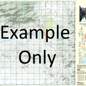
This Topographic Map is produced by Geoscience Australia; Australia s national geospatial organisation.
GA topographic maps (many of which are produced in partnership with the Army) are generally older than those maps produced by the State Governments over the same area. This makes GA maps particularly useful for identifying historic features, such as old mines and diggings.
Geoscience Australia maps generally considered to be more pleasing in design and compilation then the more modern State Government productions.
At this scale, 2cm on this map represents 1km on the ground. A standard map (which is square) covers an area of approximately about 25km by 25km, with a contour interval of 10m. This map contains natural and constructed features including road and rail infrastructure, vegetation, hydrography, contours, localities and some administrative boundaries.
Please note the date of the map, as this will impact the currency of information, particularly regarding infrastructure, roads, etc.
Carrung-Kohndunna Pool Culcra Bore Jarradubundy Bore Pamprunnah Pool Togobinna Pool Tonimelba Pool Wadgawaranna Pool Wongajerra Pool Wongajerra Well Wongajuda Pool Jackies Well Wannery Creek Goordeman Pool Tojungunna Pool Murgundarra Pool Kojurrunna Pool Corbingmenna Pool Kohlbing Karrung Pool Carrung Kohndunna Pool Carruddgurunna Pool Eurentogie Pool Talatalla Well Wojaweranna Pool Pirrirebegonna Pool Ullawarra
| Title | Paper, Laminated |
|---|
Related products
-
QLD 7369-2 Supply
$12.50 -
QLD 7371-3 Discount
$12.50 -
QLD 7368-2 For Discount
$12.50 -
QLD 7372-1 Sale
$12.50 -
QLD 7370-3 Sale
$12.50